 Birch Hill Dam is located in Royalston on the Millers River, 11 miles northeast of Athol and 75 miles northwest of Boston. From Gardner, it can be reached traveling 11 miles north on Route 68. The Lake Denison Recreation Area is located on U.S. 202 north of Baldwinville.
In conjunction with the dam at Tully Lake, Birch Hill Dam provides flood protection to Athol, Orange, and other communities on the Millers River. Birch Hill Dam also helps to reduce damages along the main stem of the Connecticut River.
Construction of the dam began in June 1940 and was completed in February 1942 at a cost of $4.8 million. A New England Power Company power line and a portion of U.S. Route 202 were relocated. The project has prevented $78.1 million in flood damages since it was built (as of September 2011).
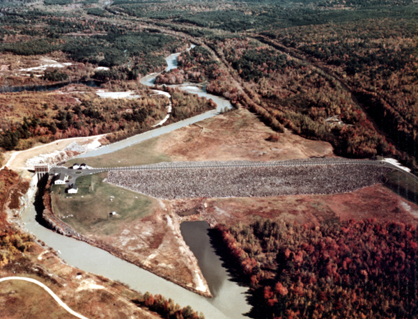
The project consists of an earthfill dam with stone slope protection 1,400 feet long and 56 feet high; four gated rectangular conduits, each six feet wide, 12 feet high, and 34 feet long; and three concrete chute spillways, each with a concrete weir. The three weirs have a total length of 1,190 feet and have crest elevations that are 12 feet lower than the top of the dam.
There is no lake at Birch Hill Dam. Lake Denison, a natural lake situated within the project grounds, is located two miles upstream of the dam. The flood storage area of Birch Hill Dam, which is normally empty and is only utilized to store floodwaters, covers 3,200 acres and extends upstream through the towns of Royalston, Winchendon, and Templeton. The project and associated lands total 4,637 acres. When combined with the adjoining Otter River State Forest that is operated by the state, over 8,500 acres are available to the public. Birch Hill Dam can store up to 16.26 billion gallons of water for flood control purposes. This is equivalent to 5.3 inches of water covering its drainage area of 175 square miles.
The Reservoir Control Center (RCC) is the "nerve center" for the New England flood control dams such as Birch Hill Dam. Using radio and satellite communications, the team constantly monitors river levels and weather conditions that influence flood control decisions. The Reservoir Control Center provides information about river flows, dam operations, snow depths, recreational water releases, and more.
For more information, or for recreation opportunities call (978) 249-4467 or visit the website at: http://www.nae.usace.army.mil/Missions/Recreation/BirchHillDam.aspx.
- Updated: May 5, 2021