 The Narrows of Lake Champlain is a 37-mile-long section of waterway at the southern end of Lake Champlain and forms a partial border between Vermont and New York. The waterway is used chiefly by recreational boats and commercial ships transporting petroleum products.
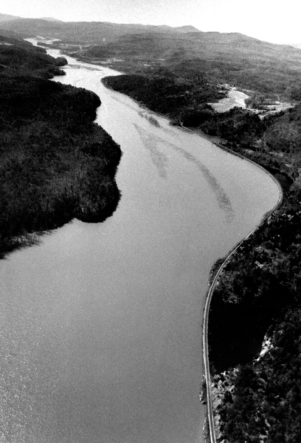
The project lies within the 37 miles of the Narrows and consists of a 13.5-mile-long, 12-foot-deep channel extending northerly from the canal lock at Whitehall, New York, past West Haven, to Benson Landing in Benson. The channel is generally 150 feet wide except at The Elbow, which is located in Whitehall across from West Haven and near the confluence of the Poultney and Mettawee Rivers. The width of the channel at this point is 110 feet. Fender booms were installed at The Elbow (specifically at Putts Leap and Putts Rock) and opposite the railroad trestle that crosses the inlet to South Bay. The railroad trestle is about one mile northwest of The Elbow. Work was completed in 1923.
Originally designed for a channel width of 200 feet, the project is considered adequate for the safety of present day navigation.