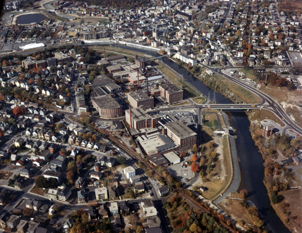
The Lower Woonsocket Local Protection Project in Woonsocket is located along the Blackstone River and two of its tributaries, the Mill and Peters rivers, in an area downstream of the South Main Street Bridge.
The project, in conjunction with the Woonsocket Local Protection Project located upstream and West Hill Dam in Uxbridge, Massachusetts, protects industrial and commercial establishments and densely populated residential areas from flood flows on the Blackstone, Mill, and Peters rivers.
The project was built between December 1963 and April 1967 at a cost of $8.3 million. Construction required the alteration of utilities at five points along the east bank of the river where the two pressure conduits cross existing streets.
The project consists of work in three areas of Woonsocket: the Social District Unit, the Hamlet District Unit, and the Bernon Unit. Work in the Social District Unit involved improvements on the Blackstone, Mill, and Peters rivers. On the Blackstone River, the Corps constructed an 1,860-foot-long earthfill dike with stone slope protection and three concrete floodwalls totaling almost 1,100 feet, both along the river’s left bank. A pumping station removes interior drainage behind the dike and floodwalls during flood periods. Also, about 600 feet of the Blackstone River was deepened. Improvements on the Mill River include construction of 2,410 feet of dike, four concrete floodwalls that total 600 feet in length, 1,700 feet of channel excavation, and a 1,150-foot-long concrete pressure conduit that passes beneath Social Street, John A. Cummings Way, and Clinton Street. The conduit is a twin-barreled structure, with each barrel 12 feet high and 21 feet wide. As part of its improvements on the Mill River, the Corps replaced the East School Street Bridge so that the eastern bridge abutment could be tied into a floodwall, strengthening the project’s flood damage reduction capabilities. Improvements on the Peters River include construction of 770 feet of earthfill dike, 250 feet of concrete floodwall, 400 feet of channel excavation, and an 1,180-foot-long concrete pressure conduit, 10 feet high and 17 feet wide, that passes beneath Elm, Godfrey, and Cumberland streets.
Work in the Hamlet District Unit entailed construction of three earthfill dikes with stone slope protection that total almost 3,100 feet on the Blackstone River’s right bank; 75 feet of concrete floodwall between the upper two dikes; a pumping station behind the lower dike that discharges interior drainage during flood periods; and about 2,000 feet of channel excavation on the Blackstone River. In addition to this work, the Corps removed the Hamlet Dam.
In the Bernon Unit, the Corps removed the 194-foot-long Bernon Dam on the Blackstone River; constructed a pilot channel, 50 feet wide and 600 feet long, between the former dam and the Bernon Street Bridge; and modified the bridge by removing a steel truss beneath the bridge and raising utility conduits, allowing flood flows to pass underneath.