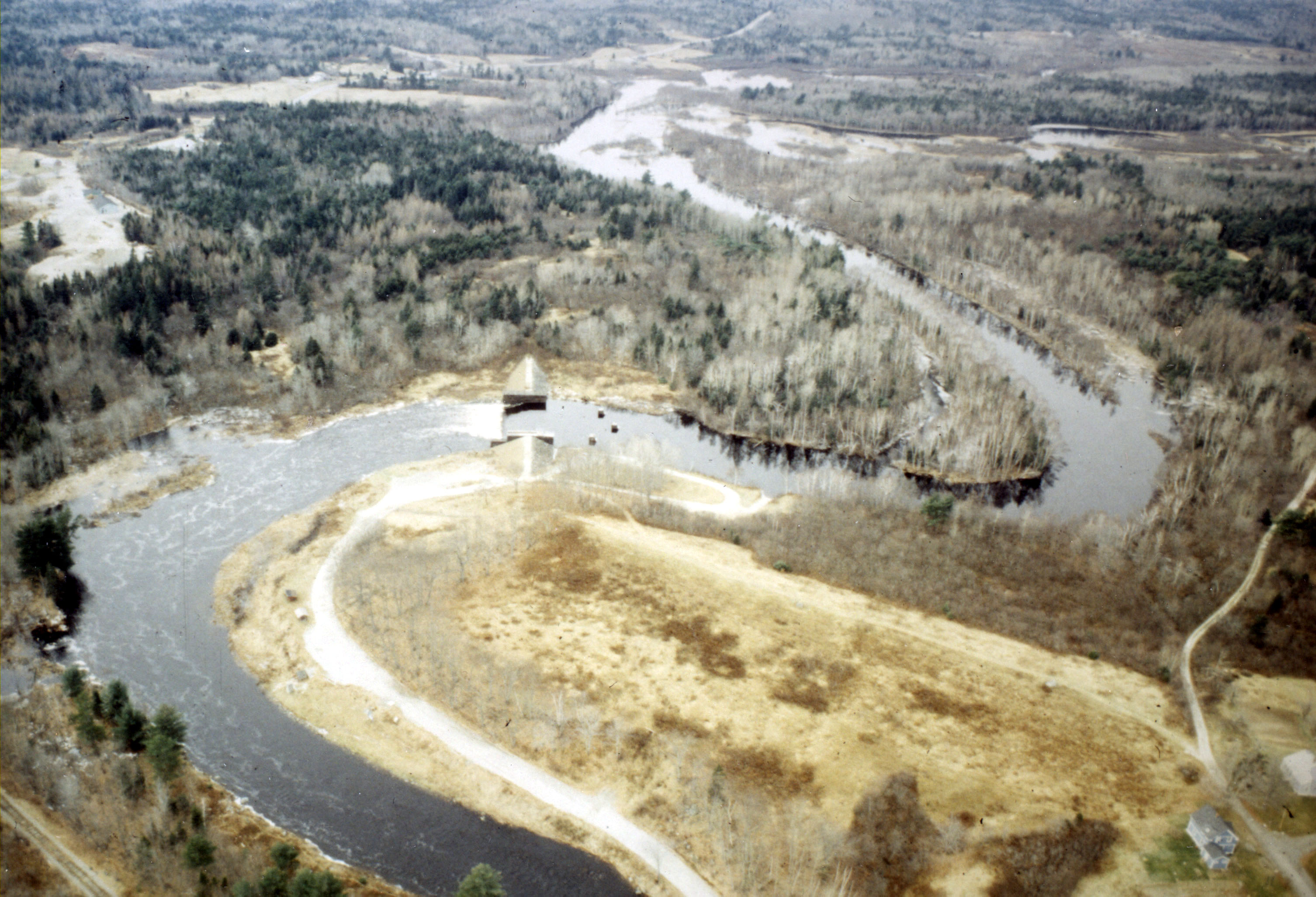
The Cherryfield Local Protection Project is located on the Narraguagus River, one mile upstream from the center of Cherryfield. The town is a small berry-producing and fruit canning center about 20 miles northeast of Bar Harbor.
The Narraguagus River is subject to ice jams, which can cause severe flooding. The Cherryfield Local Protection Project is designed to reduce damages from flooding caused by ice jams. It safeguards Cherryfield’s major industries, nearly half of the town’s business establishments, approximately 25 homes, and several public buildings.
The project was constructed between June-December 1961 and cost $203,000. It was built under Section 205 of the Continuing Authorities Program and is maintained by Cherryfield.
The project creates an artificial lake that either holds ice upstream until it decays in the spring or delays its movement downstream until after existing ice downstream breaks up. The structure, about 500 feet long, consists of two 24.5-foot-high timber crib abutments filled with stone, two earthfill embankments, 135 feet long on the east bank and 180 feet long on the west bank, and a 140-foot-long timber crib spillway, also filled with stone. The structure has provisions for stoplogs. Incorporated in the east abutment is a fishway that allows Atlantic salmon and other migratory fish to pass.