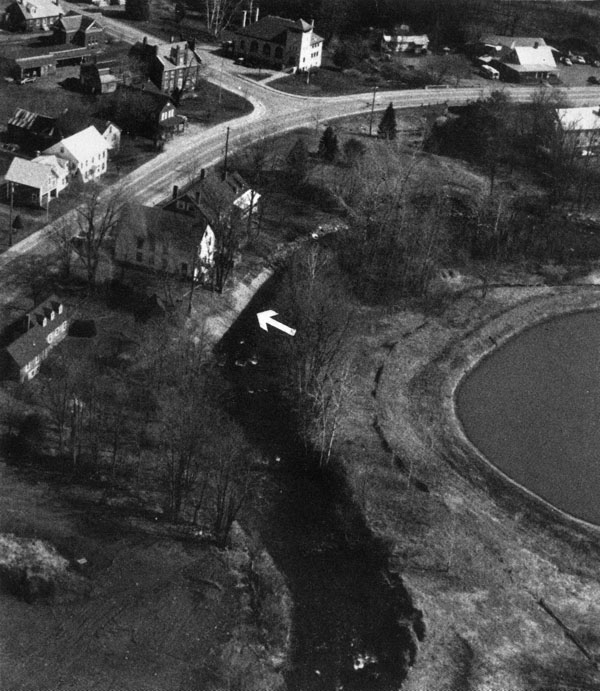
The project on Mill Brook is situated along the brook’s northern bank in the Brownsville section of West Windsor, about 12 miles north of Springfield. The project lies adjacent to Gleanor Grange Hall in West Windsor’s Historical District, about 150 feet upstream of the junction of Mill and Beaver Brooks.
Erosion along Mill Brook’s northern bank from high velocity flows and ice jams brought the brook to within 13 feet of Gleanor Grange Hall’s foundation and only five feet from the hall’s fire escape. The eroding bank threatened to undermine several large trees and eventually the hall.
To stabilize the bank and maintain the integrity of the hall, the Corps constructed slope protection, consisting of interlocking concrete grid blocks, along 120 feet of streambank. The Corps also placed six to eight boulders, each with a diameter of about four feet, in the brook for fishery habitat. Built as a small project under Section 14 of the Continuing Authorities Program, the work at Mill Brook was constructed between June-October 1987 at a cost of $110,000.
Mill Brook rises in Reading and flows in a generally easterly direction for 16 miles before entering the Connecticut River at Windsor. From Reading through West Windsor, Mill Brook flows in a northeasterly course for approximately 11 miles. Upon entering Windsor, Mill Brook flows initially in a southeasterly direction, then abruptly changes course and flows northerly into Mill Pond in Windsor. Upon leaving Mill Pond, Mill Brook flows northeasterly for approximately one mile before entering the Connecticut River at Windsor.