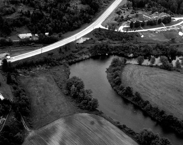
This project, located in the West Stewartstown section of Stewartstown, is situated along the Connecticut River in the northwest corner of the state, near New Hampshire’s border with Canada and Vermont. It is about 150 miles north of Concord.
Three severe floods within a 13-month span caused serious crop damage at the farm division of Coos County Institution in West Stewartstown. In addition to a farm, this 1,100-acre facility, established in 1867, includes a jail and nursing home. In June 1973, 200 feet of a privately-built earthfill dike was breached, resulting in high velocity floodwaters racing across the low-lying farm fields. About 60 acres of crops were flooded to an average depth of one to two feet, substantially eroding the topsoil. In December 1973 and in July 1974, the farm again experienced severe flooding, with the river trying to establish a new course through the farmlands.
To protect the farm fields and crops, the Corps constructed a total of 657 feet of earthfill dike with stone slope protection in two places along the left bank of the Connecticut River.
The work replaces the section of dike that was breached and provides additional protection to the existing dike. The northerly dike work is 500 feet long, and the southerly dike work is 157 feet long. Although the project will not prevent over bank flooding, it will protect the farmlands from high velocity flooding and prevent further soil erosion and subsequent deposition downstream.
The project was constructed between November - December 1975 at a cost of $54,700. It was constructed under Section 14 of the Continuing Authorities Program.