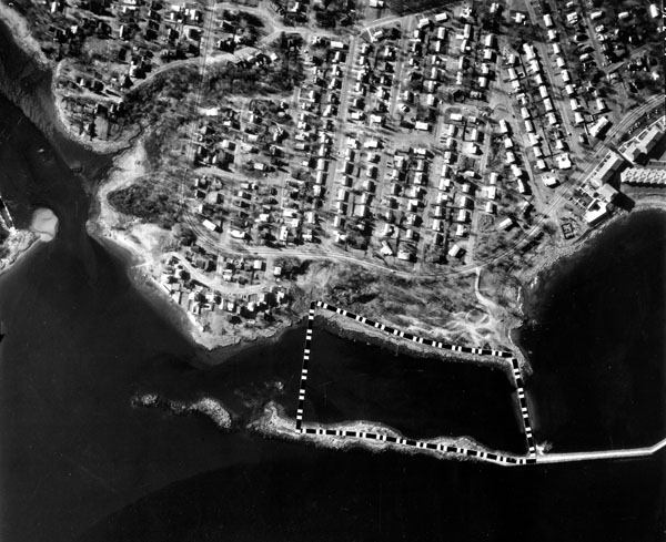
Pawtuxet Cove lies along the Cranston-Warwick city line at the mouth of the Pawtuxet River, which discharges into Providence Harbor. The cove serves primarily as a base for recreational boating.
The project, completed in 1966, consists of:
- A six-foot-deep channel, 100 feet wide, extending westerly from deep water in the Providence River to the cove entrance, then turning northerly up the cove behind Washout Point to the head of the cove at Cranston;
- A six-foot-deep turning basin at the head of the cove, across from the mouth of the Pawtuxet River;
- A six-foot-deep anchorage, 14 acres in area, situated south of the cove entrance and north of Warwick Downs State Park; and
- A 2,200-foot-long stone dike along the east side of the anchorage. The 12-foot-high dike extends northward from Rock Island to Marsh Island and affords shelter and protection to the cove.