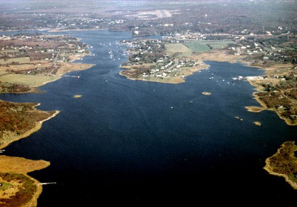
The Pawcatuck River rises in Worden Pond, situated in the Great Swamp in South Kingstown, and follows a 33-mile-long course, meandering mostly through open and sparsely settled country having a multitude of lakes and swamps. The river flows in a generally southwesterly direction into Little Narragansett Bay at the Rhode Island-Connecticut state line. The lower part of the river forms the boundary between Stonington and North Stonington, Connecticut, and Westerly, Rhode Island.
Initial work on the project was completed in 1903, with the most recent improvement work completed in 1949. The project consists of:
- A 7.5-mile-long, 10-foot-deep channel extending easterly from Stonington Point in Connecticut, located on Little Narragansett Bay’s western end, through Little Narragansett Bay and then northerly up the Pawcatuck River to the upper wharves in Westerly. The channel is 100 feet wide from Stonington Point to the lower wharves at Westerly (about seven miles), then narrows to 40 feet for 0.5 mile to the upper wharves.
- A 0.28-mile-long channel, 10 feet deep and 100 feet wide, extending southerly from the mouth of the Pawcatuck River into Watch Hill Cove in Westerly.
- A 10-foot-deep anchorage basin, 16 acres in area, in Watch Hill Cove.
- A 200-foot-long stone jetty near the southwestern end of Watch Hill Cove.