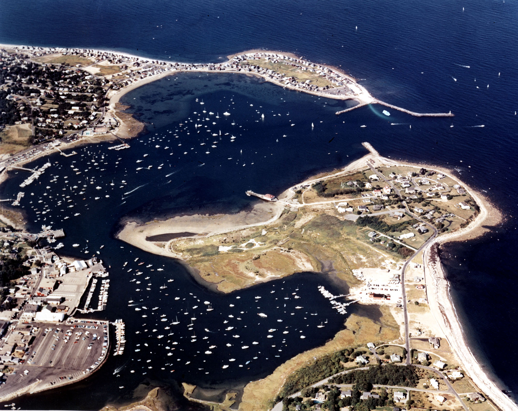
Scituate Harbor in Scituate Harbor is an indentation along Massachusetts’ southern shore, approximately 13 miles southeast of Boston Harbor. The harbor is used chiefly by fishing and recreational fleets.
The earliest work in Scituate Harbor, between 1829-1852, consisted of a stone bulkhead 835 feet long that protected the beach between Cedar Point and the mainland. In 1903, work was completed on two jetties, one on each side of the harbor entrance. The north jetty extends 720 feet southeasterly from Cedar Point, and the south jetty extends 450 feet northerly from First Cliff. The Corps also dredged areas of the harbor to facilitate navigation.
The Corps’ most recent work in Scituate Harbor consists of:
- A 0.8-mile-long channel extending from deep water to an anchorage at the head of the inner harbor. From deep water extending to a point about 70 feet west of the jetty at First Cliff, the channel is 12 feet deep and 200 feet wide. From this area to a point about 50 feet south of the Scituate Town Wharf, the channel is 10 feet deep and 200 feet wide. From this area to the anchorage at the head of the inner harbor (a distance of 450 feet), the channel is 10 feet deep and 150 feet wide.
- A 10-foot-deep anchorage basin along the northerly side of the 10-foot-deep channel’s first 1,500 feet. The anchorage has an average width of about 460 feet.
- An extension of the aforementioned 10-foot-deep anchorage. This anchorage is eight feet deep, 1,500 feet long, and about 400 feet wide, and lies between the 10-foot anchorage and the shoreline.
- An anchorage area at the head of the inner harbor. The basin has a depth of 10 feet, a length of 900 feet, and varies in width from 300-500 feet.
- A 300-foot-long extension of the north jetty at Cedar Point. This work also included rehabilitating the rest of the north jetty and the entire south jetty at First Cliff.
- The Commonwealth of Massachusetts has constructed two projects in Scituate Harbor. The first is a breakwater that extends southwesterly off Cedar Point; the second is a six-foot-deep anchorage, 0.2 mile in length, that lies between the 10-foot-deep channel and the shoreline (in front of the municipal park and parking area).