 Sandy Bay in Rockport is a large bight in the northeastern shore of Cape Ann. Bordered by Andrews Point to the north and Gap Head and Straitsmouth Island to the south, Sandy Bay includes Pigeon Cove, Knowltons Harbor, Old Harbor, and Rockport Harbor. The bay is partially protected by Abners Ledge, which lies about 1.5 miles northeast of Rockport Harbor.
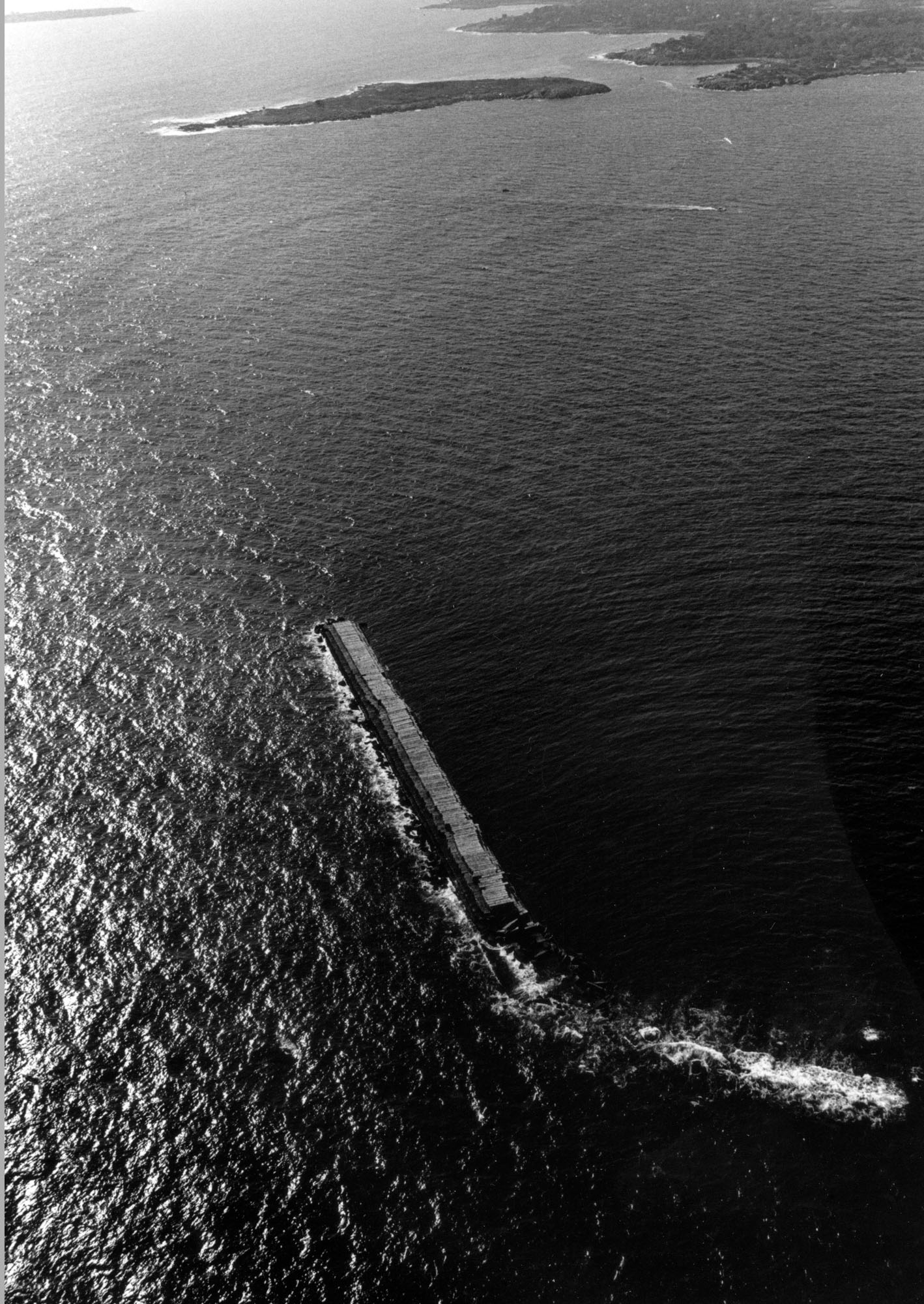
The project originally called for the construction of a 9,000-foot-long stone breakwater, 22 feet high, that would provide a harbor of refuge for commercial vessels sailing the coast around the turn of the century. The breakwater was to extend 3,600 feet north from Averys Ledge to Abners Ledge, then 5,400 feet northwesterly from Abners Ledge toward Andrews Point. The anchorage area encompassed by these dimensions would be about 1,377 acres.
About 922 feet (26 percent) of the breakwater, including both superstructure and substructure, was complete when construction was suspended in 1911. Another 6,100 feet of the breakwater’s substructure, extending from both ends of the already completed 922-foot breakwater at Abners Ledge, had been built when construction ceased. These sections of substructure, now awash at low water, are marked by navigation aids. No further work on the breakwater is anticipated.