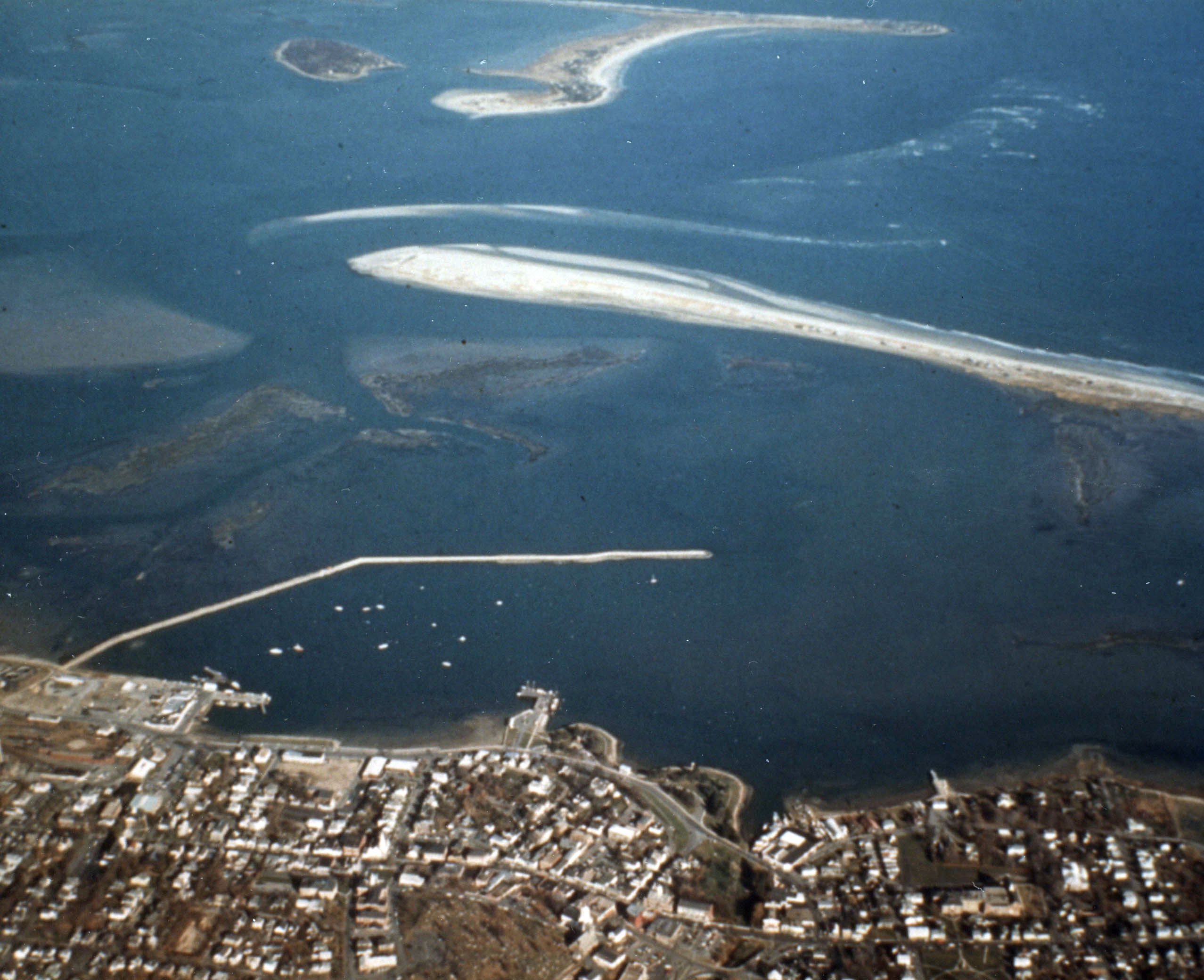
Plymouth Harbor is located in Plymouth Bay, about 18 miles north of the Cape Cod Canal. It is partially protected by Long Beach, a 3.6-mile long spit that extends along the harbor’s east side, giving Plymouth Harbor a V-shaped form. Plymouth’s place in history annually attracts hundreds of recreational and transient boaters to the harbor, which is also a popular center for charter excursion and sport fishing boats.
Initial work in the harbor, completed in 1893, involved dredging a channel in the inner harbor and a basin in front of the town wharf, both to a depth of nine feet. Work also included protecting Long Beach from erosion to prevent further damage to the harbor.
The most recent work by the Corps in Plymouth Harbor consists of:
- A stone dike along sections of Long Beach that were damaged by the storm of November 1898.
- The restoration of the Eel River, at the southernmost end of the harbor, to its former course.
- An 18-foot channel, 200 feet wide, and about 2.5 miles long, extending from Plymouth Bay for nearly a mile along the inner shore of Long Beach, and then continuing generally westerly to the state pier, with a large turning basin at the channel’s end. The Corps’ turning basin is opposite state-constructed anchorage and turning basin areas.
- A 15-foot access channel, 150 feet wide, extending about 0.3 mile north from the Corps’ turning basin, along the central waterfront, to the town wharf. There is a two-acre turning basin at the end of the channel in front of the wharf that is 15 feet deep.
- A 3,500-foot-long stone breakwater. This structure begins at a point north of the town wharf and extends easterly from the shore for 1,400 feet, then turns southeasterly, parallel to the waterfront, for 2,100 feet.
- An anchorage basin eight feet deep and 60 acres in area inside the breakwater.