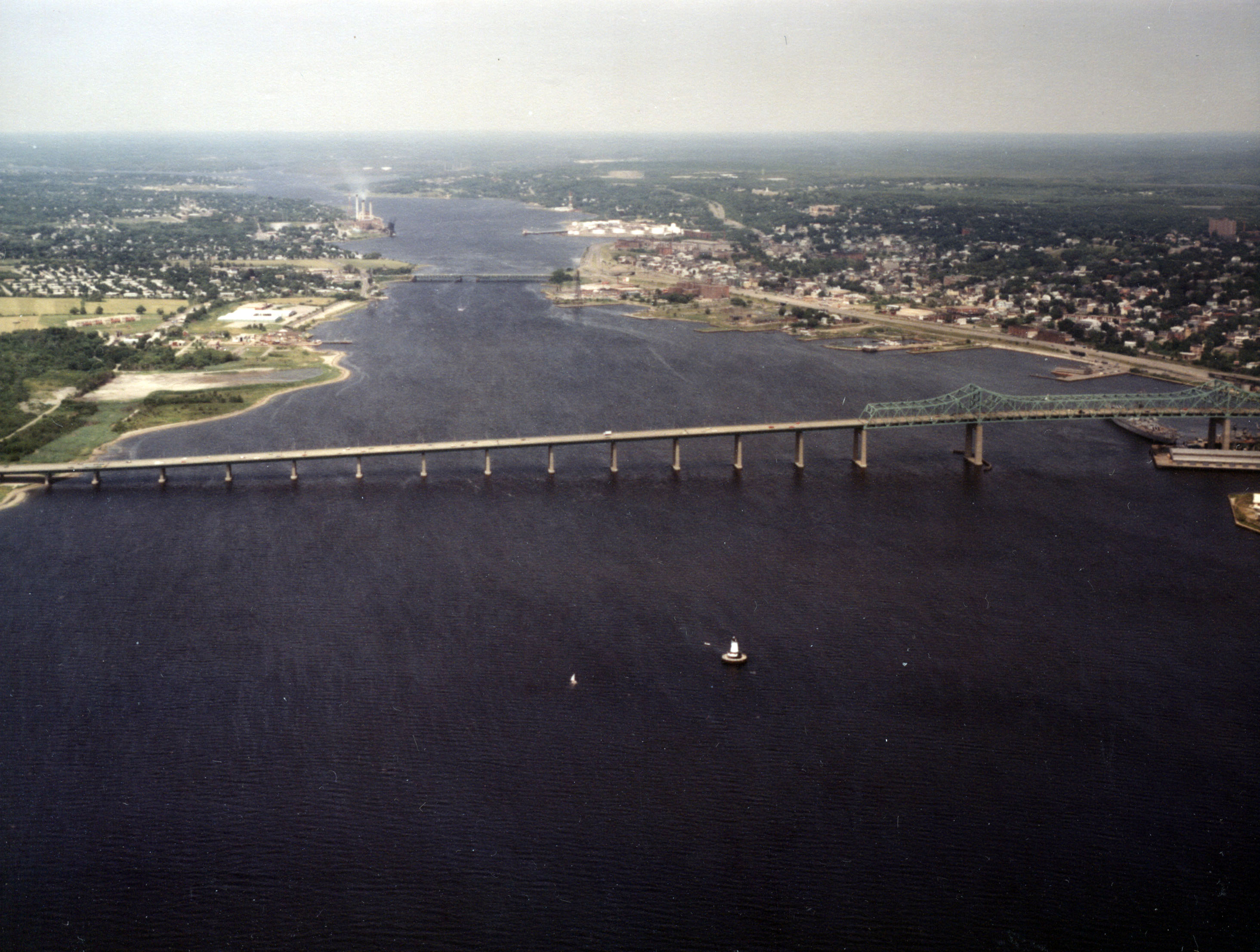
Fall River Harbor is located in the upper reaches of Mount Hope Bay in Fall River, about 15 miles southeast of Providence. It is situated at the mouth of the Taunton River and at the head of the Sakonnet River, which lies between the Rhode Island communities of Portsmouth and Tiverton. Fall River Harbor is a major oil receiving port.
The earliest work in Fall River Harbor, completed in 1915, involved the construction of a channel 25 feet deep through Mount Hope Bay to the inner harbor along the Fall River waterfront, and for an anchorage 25 feet deep and 42 acres in area adjoining Old Colony Wharf, now the State Pier. Additional work in Fall River Harbor, completed by the Corps in 1959, consists of:
- A channel 35 feet deep and 400 feet wide extending east from deep water in Mount Hope Bay into the Tiverton shorefront, where it branches into northern and southern channels along the Tiverton waterfront. The northern channel ends in the vicinity of the Gulf Oil Terminal; the southern channel extends along the Tiverton Lower Pool waterfront to the vicinity of the Rhode Island Refining Corporation. Both the northern and southern channels are 35 feet deep and 400 feet wide.
- A channel 35 feet deep and 400 feet wide extending from deep water in Mount Hope Bay to a point on the Taunton River between Shell Wharf in Fall River and Montaup Wharf in Somerset. From Mount Hope Bay, the channel stretches north past the Braga Bridge (Interstate I-195), along the Fall River waterfront, past the Brightman Street Bridge (U.S. Route 6) to the Shell and Montaup wharves. The channel increases in width where it bends, just north of the Braga Bridge.
- A 35-foot-deep turning basin, about 1,100 feet wide and 850 feet long, between the Shell and Montaup Wharves.