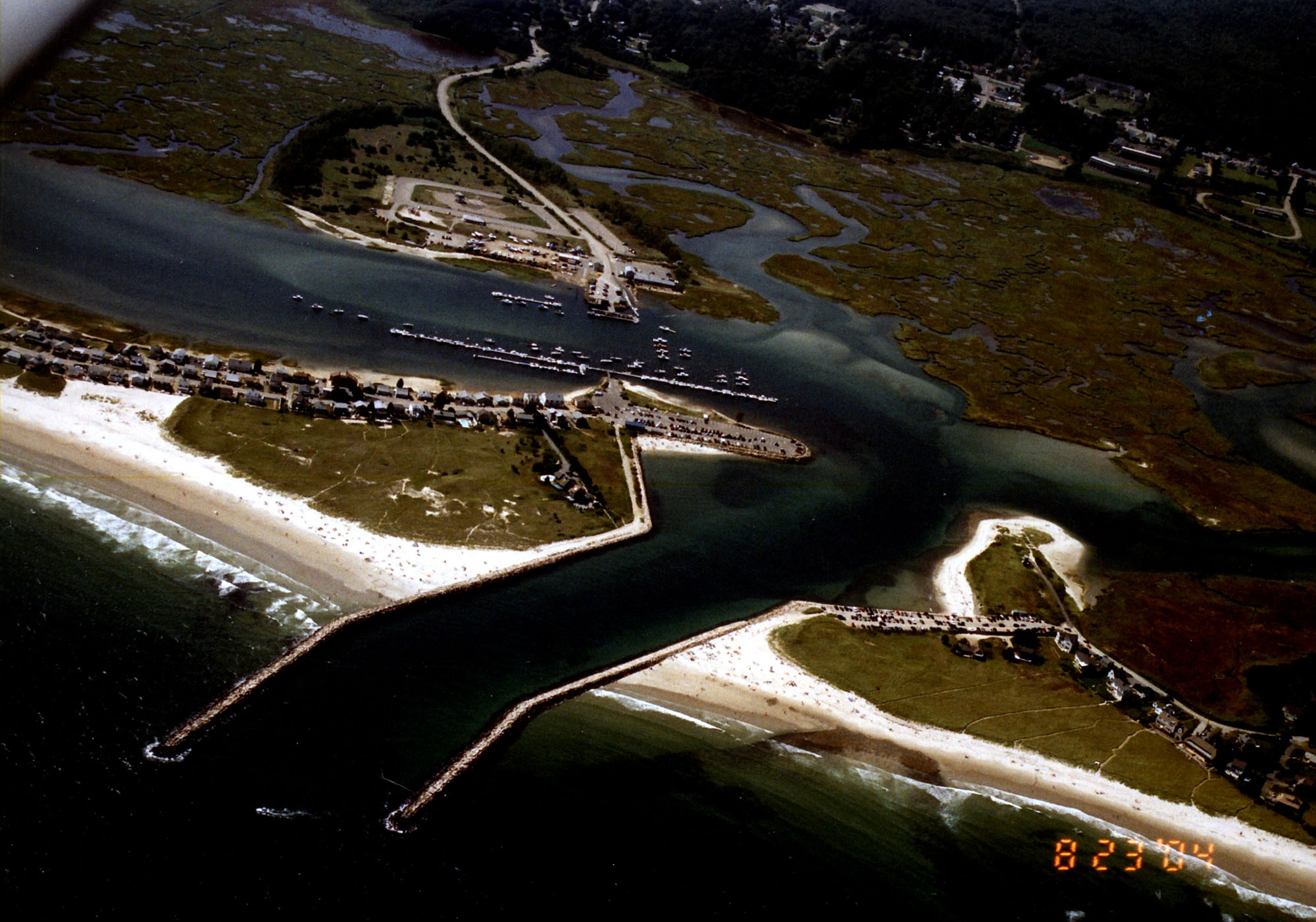
Wells Harbor in Wells is located at the mouth of the Webhannet River, 20 miles south of Portland. The protected harbor is home to small recreational and fishing fleets.
Original work in Wells Harbor began in 1835, when a 750foot-long wooden pier was constructed on Drakes Island at the northern entrance point to the harbor. Repaired in 1873, only the pilings remain today. The existing project, completed in 1967, includes:
- An eight-foot-deep entrance channel, 100 feet wide, extending 3,000 feet from deep water in the Atlantic Ocean to a point opposite the northern end of Wells Beach.
- A six-foot-deep inner channel that starts at the end of the eight-foot-deep channel and turns southerly toward the protected harbor and town landing behind Wells Beach, ending about 700 feet south of the town landing. The channel is 150 feet wide, but narrows to 100 feet as it turns southerly.
- A six-foot-deep anchorage, 7.4 acres in area, parallel to the inner harbor channel opposite the town landing.
- A 10-foot-deep settling basin immediately south of the six-foot-deep anchorage and inner channel. A settling basin is an area dredged to reduce the effects of shoaling.
- Two parallel stone jetties at the harbor entrance that create an opening 400 feet wide. The north jetty extends 2,065 feet southeasterly from Drakes Island, and the south jetty extends 2,240 feet easterly from Wells Beach.
- A revetment at the northern tip of Wells Beach. Work also included sand replenishment.
Some of the sand dredged from the harbor during initial construction and subsequent maintenance has been used to replenish and nourish Wells Beach and other nearby beaches.