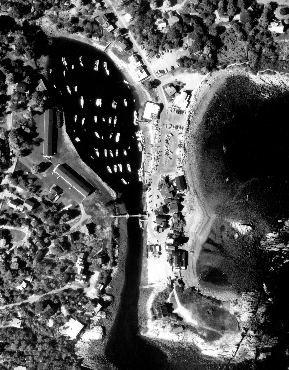
The Josias River flows eastward into Perkins Cove in Ogunquit, about 16 miles northeast of Portsmouth and 30 miles south of Portland. Perkins Cove is well-known for its scenery and is used extensively by local and transient recreational boats, sportfishing and charter craft, and lobster boats.
The project, completed in 1951, consists of:
-
A five foot deep anchorage at the head of the cove, 3.2 acres in area, in what was formerly known as Flat Pond. The anchorage has a maximum width of 400 feet.
-
A 900 foot long channel, five feet deep and 40 feet wide, extending from Perkins Cove to the aforementioned anchorage.
In 1960, the Corps enlarged the anchorage by one acre in area, keeping its depth at five feet. The anchorage now has a surface area of 4.2 acres.
In 1993, the five-foot deep entrance channel and half of the anchorage area were deepened to seven feet, except in area of ledge.