 The Mystic River extends from Mystic Harbor in Mystic six miles upstream to Old Mystic. Both Mystic and Old Mystic are sections of Stonington.
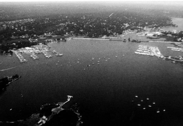
The river is mainly used by fishing and recreational craft. A popular attraction is Mystic Seaport, a reconstructed seacoast village depicting 19th century waterfront development.
Work on the Mystic River began in 1890; several improvements have been made since then. Navigational work the Corps has completed in the river include:
-
A 3.75-mile-long channel stretching from Fishers Island Sound to a point 700 feet above the wharf at the Mystic Seaport Marine Historical Association. The channel has varying dimensions. It is 15 feet deep and 125 feet wide beginning in Fishers Island Sound, extending north along the Noank waterfront in Groton, continuing between Sixpenny and Mason Island in Stonington to Murphy Point in Mystic (2.4 miles). From Murphy Point to the U.S. Route 1 Bridge at Mystic (0.55 miles), the channel is 15 feet deep and 100 feet wide. From the bridge to the point 700 feet above the Mystic Seaport Marine Historical Association Wharf (0.8 mile), the channel is 12 feet deep and 80-90 feet wide.
-
An anchorage basin nine feet deep and 8.5 acres in area on the east side of the channel and north of Mason Island.
-
A turning basin nine feet deep, 200 feet wide, and 200 feet long immediately north of the railroad bridge and east of the channel.