 The Winooski River Local Protection Project is located along an approximately 6.5-mile-long stretch of river that flows through Montpelier, Berlin, Moretown, and Middlesex.
In conjunction with East Barre Dam, Waterbury Reservoir, and Wrightsville Reservoir, the Winooski River Local Protection Project protects several thousand acres of farmland and reduces flood damage in many downstream communities, including Montpelier, Middlesex, Waterbury, and Duxbury. Data on damages prevented are not available.
Construction of the project began in 1934 and was completed in the spring of 1938. The Winooski River Local Protection Project was one of four flood damage reduction projects built in Vermont by the Civilian Conservation Corps in the 1930s. Construction was overseen by the Corps’ North Atlantic Division. Because of accounting procedures, the construction costs of this project were not calculated separately, but instead lumped together with the construction costs of East Barre Dam, Waterbury Reservoir, and Wrightsville Reservoir. The construction costs of these four projects totaled $13.7 million.
The project consisted of:
- Replacing an old timber dam at Montpelier by a small concrete dam (now called Bailey Dam) with tainter gates.
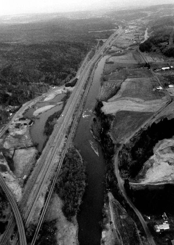
- Clearing and grading one mile of river bank above the dam. In the upper half-mile of this reach, several sections of the banks were cut back considerably to enlarge the channel. Stone slope protection was then placed on these sections of bank.
- Removing projecting ledges and points that restricted Winooski River flows at five separate places between Middlesex and Montpelier. The removed ledge rock was used as part of the stone slope protection described above.
The Winooski River rises from Coits Pond in Cabot and flows for approximately 90 miles before emptying into Lake Champlain in Burlington. From Cabot, the river flows southwesterly through Marshfield, Plainfield, East Montpelier, and northeastern Berlin. At this point the river changes direction and flows in a northwesterly course through Montpelier, northwestern Berlin, Moretown, Middlesex, Waterbury, Duxbury, Bolton, Richmond, Williston, Jericho, Essex, South Burlington, Winooski, and Colchester before emptying into Lake Champlain at Burlington.
Following the devastating flooding of downtown Montpelier in March 1992, a new Corps study identified the severity of the problem and the feasibility of a Federal solution. Local interests were unwilling to cost-share any additional phases of study and project development.