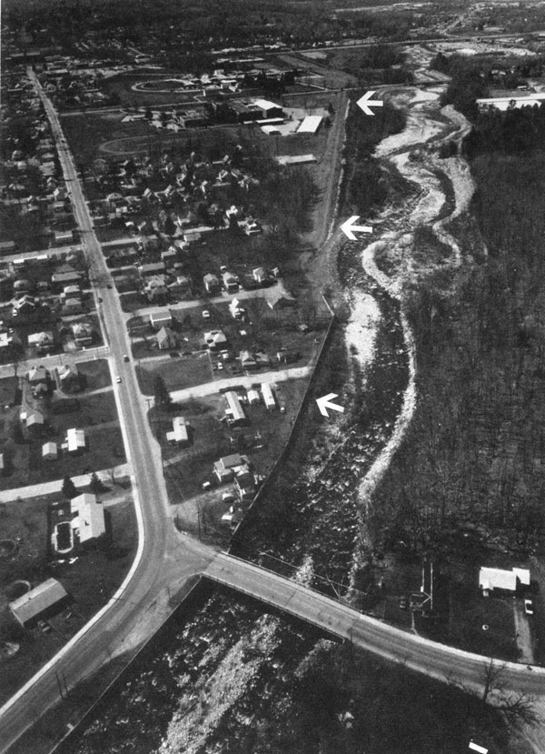
 The Bennington Local Protection Project is located along the left bank of Roaring Branch, a tributary of the Walloomsac River, in Bennington.
The project protects Bennington from damage caused by the floodwaters of Roaring Branch.
Construction of the project, built by the Corps’ New York District began in June 1970 and was completed in November 1971 at a cost of $670,000. The project is operated and maintained by Bennington.
The project, about one mile in length, begins about 1,000 feet upstream of the Brooklyn Bridge and ends on Park Street. It consists of:
- Two sections of earthfill dike with stone slope protection, that total 3,710 feet. The first section, about four feet high, begins about 1,000 feet upstream of the Brooklyn Bridge and extends downstream for 530 feet. The second section begins about 700 feet downstream of the Brooklyn Bridge and ties into high ground adjacent to Mount Anthony Union High School on Park Street. This dike is 3,180 feet long and averages six feet high.
- Three sections of concrete floodwall with stone slope protection that total 1,472 feet. These include two sections of newly constructed concrete floodwall totaling 147 feet, and a 1,325-foot-long floodwall that was originally built by the town as a Works Progress Administration (WPA) project in 1939. The first section of floodwall, newly constructed, starts about 500 feet upstream of the Brooklyn Bridge and extends for 34 feet before tying into the second section of floodwall, which is the WPA floodwall. The third section of floodwall is located immediately downstream of the WPA floodwall and is 116 feet long.
- Four drainage structures. One is located along the east side of Park Street, about 400 feet southeast of the Park Street Bridge; the second is located about 130 feet from the northeast end of Congress Street; the third is located about 70 feet from the northeast end of Bradford Street; and the fourth is located approximately 610 feet northeast of the intersection of Branch and Gage Streets.
- A ponding area, measuring about 350 feet by 250 feet, that impounds excess storm water in conjunction with the first drainage structure described above. The ponding area is located on the east side of Park Street, about 450 feet south of the Park Street Bridge.
- A pumping station located adjacent to the ponding area and the first drainage structure.
During the floods of December 1948 and August 1950, a 725-foot-long section of the WPA-built floodwall was seriously damaged. The Corps reconstructed this section of floodwall as a small project under Section 208 of the Continuing Authorities Program. Construction was initiated in July 1951 and was completed in April 1952 at a cost of $196,000. This 725-foot-long section of the WPA-built floodwall was later incorporated as part of the Bennington Local Protection Project.
During August 9-12, 1976, heavy rains from Hurricane Belle caused flooding throughout Vermont. These rains undermined a 250-foot-long section of floodwall by dislodging the stone slope protection at its base and exposing its footing. The placement of additional stone slope protection to secure the floodwall was completed in June 1977 at a cost of $18,000.