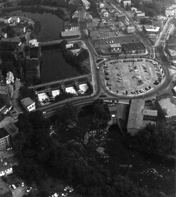
 The Woonsocket Local Protection Project is located in the industrial area of Woonsocket along the Blackstone River. The project area extends 8,300 feet downstream from the Massachusetts state line to the center of the city near the South Main Street Bridge. A small portion of the project along the west bank of the river lies in North Smithfield.
Woonsocket suffered flood damage estimated at $22 million from the heavy rains of August 1955. The project protects about one-half of the industrial properties in the city, several homes, commercial establishments, transportation facilities, and public utilities.
The project was built between July 1956 and April 1960 at a cost of $5.4 million. Construction required the relocation of three water lines and four sewer siphons.
The project involved constructing channel improvements, a concrete floodwall, four earthfill dikes, and a pumping station; replacing an industrial dam; and modifying two railroad bridges.
Channel improvements included widening, deepening, and straightening 6,700 feet of the Blackstone River in Woonsocket and North Smithfield and constructing 1,600 feet of new channel. The work extends from the Rhode Island-Massachusetts State Line to the vicinity of the South Main Street Bridge.
The concrete floodwall is located on the river’s east bank and extends 316 feet downstream from the Singleton Street Bridge to Dike Two (discussed below). It has a height that varies between 13.5 and 21 feet.
The four earthfill dikes total 1,310 feet. Dike One, 800 feet long with a maximum elevation of 10 feet, begins about 1,200 feet south of the state line and extends along the east bank of the river to the Singleton Street Bridge. Dike Two, 240 feet long with a maximum elevation of 10 feet, extends from the south end of the floodwall and ties into high ground on the easterly bank. Both of these dikes have stone slope protection. Dike Three, 160 feet long with a maximum elevation of eight feet, lies adjacent to the southern end of Saranac Pond and extends from high ground adjacent to the railroad tracks to River Street. Dike Four, 110 feet long with a maximum elevation of five feet, is basically a continuation of Dike Three and extends from River Street to the western abutment of the Singleton Street Bridge. Dikes Three and Four protect the River Street area from Saranac Pond flooding.
The pumping station handles storm drainage behind the dikes and floodwall during high river stages. The dikes, floodwall, and pumping station protect about 20 acres of industrial property in the vicinity of Singleton Street that would otherwise be subject to flooding.
The Woonsocket Falls Dam is located about 100 feet upstream of the South Main Street Bridge. Replacing an older structure that impounded a pool used for industrial purposes, the new concrete dam is 266 feet long with a maximum height of 13 feet. It is equipped with four tainter gates, with each gate 10.1 feet high and 50 feet wide, which can be raised to allow passage of flood flows.
The modified railroad bridges are located near River Street and above Sayles Street. The Corps strengthened the underpinnings of both bridges, and also constructed a new span and abutment at the bridge above Sayles Street.