 The dam at East Brimfield Lake is located on the Quinebaug River in Sturbridge, about 20 miles southwest of Worcester and 23 miles east of Springfield. From the Massachusetts Turnpike, the project can be reached by taking exit nine, then west on U.S. Route 20 for 2.5 miles.
In conjunction with the dam at Westville Lake, the dam at East Brimfield Lake substantially reduces flood damages in Southbridge and Dudley, Massachusetts, and Putnam, Danielson, Jewett City, and Norwich, Connecticut. These communities are predominant industrial and business centers on the Quinebaug River.
Construction of East Brimfield Lake began in May 1958 and was completed in June 1960, costing $7.1 million. Town roads and portions of U.S. Route 20 were relocated. The project has prevented $129 million in flood damages since it was built (as of September 2011).
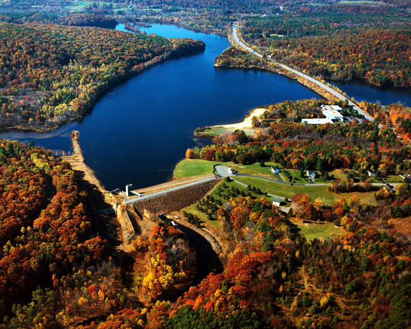
The project consists of an earthfill dam with stone slope protection 520 feet long and 55 feet high; a 210 foot long gated horseshoe conduit with a diameter of 10 feet six inches; and a chute spillway excavated in rock with a 75 foot long concrete weir. The weir’s crest elevation is 19 feet lower than the top of the dam.
There is a recreation pool at East Brimfield Lake that is 13 feet deep at the dam and covers an area of 450 acres. The American Optical Company of Southbridge can withdraw water from the reservoir as long as the reservoir does not drop below a minimum depth of nine feet. The flood storage area of the project covers 2,270 acres and extends about 5.5 miles upstream through Holland and seven miles upstream through Brimfield. This area is normally empty and utilized only to store floodwaters. The lake and all associated project lands cover 2,716 acres. East Brimfield Lake can store up to 9.74 billion gallons of water for flood control purposes. This is equivalent to 8.3 inches of water covering its drainage area of 67.5 square miles.
There are 1,480 acres of land and 590 surface acres of water available for recreational use within the project area.
The Reservoir Control Center (RCC) directs the water regulation activities for 31 flood risk management projects. RCC and team members coordinate the use of radio and satellite communications and computer programs to continuously monitor river levels and weather conditions that influence water control decisions. Using these tools and first-hand observations, the Corps of Engineers can rapidly respond to the unpredictable New England weather.
For more information, or for recreation opportunities, call (508) 347-3705 or visit the website at: http://www.nae.usace.army.mil/Missions/Recreation/EastBrimfieldLake.aspx.
- Updated: May 5, 2021