The Saco River originates in New Hampshire’s White Mountains and flows southeasterly through Maine for about 105 miles, emptying into Saco Bay at a point about 16 miles south of Portland Harbor. The river’s last six miles, which flow between the coastal cities of Biddeford and Saco, represent the area where the Corps has made several navigational improvements. Most of the fishing fleet in the area is based at Camp Ellis Harbor in Saco, about one mile upstream of the river entrance, and most of the recreational fleet is based upstream in Biddeford and Saco.
Initial work in the river began in the 1800s. More recently, the Corps has made three series of navigational improvements to the river, constructed at different times. The first improvements, completed in 1938, consist of:
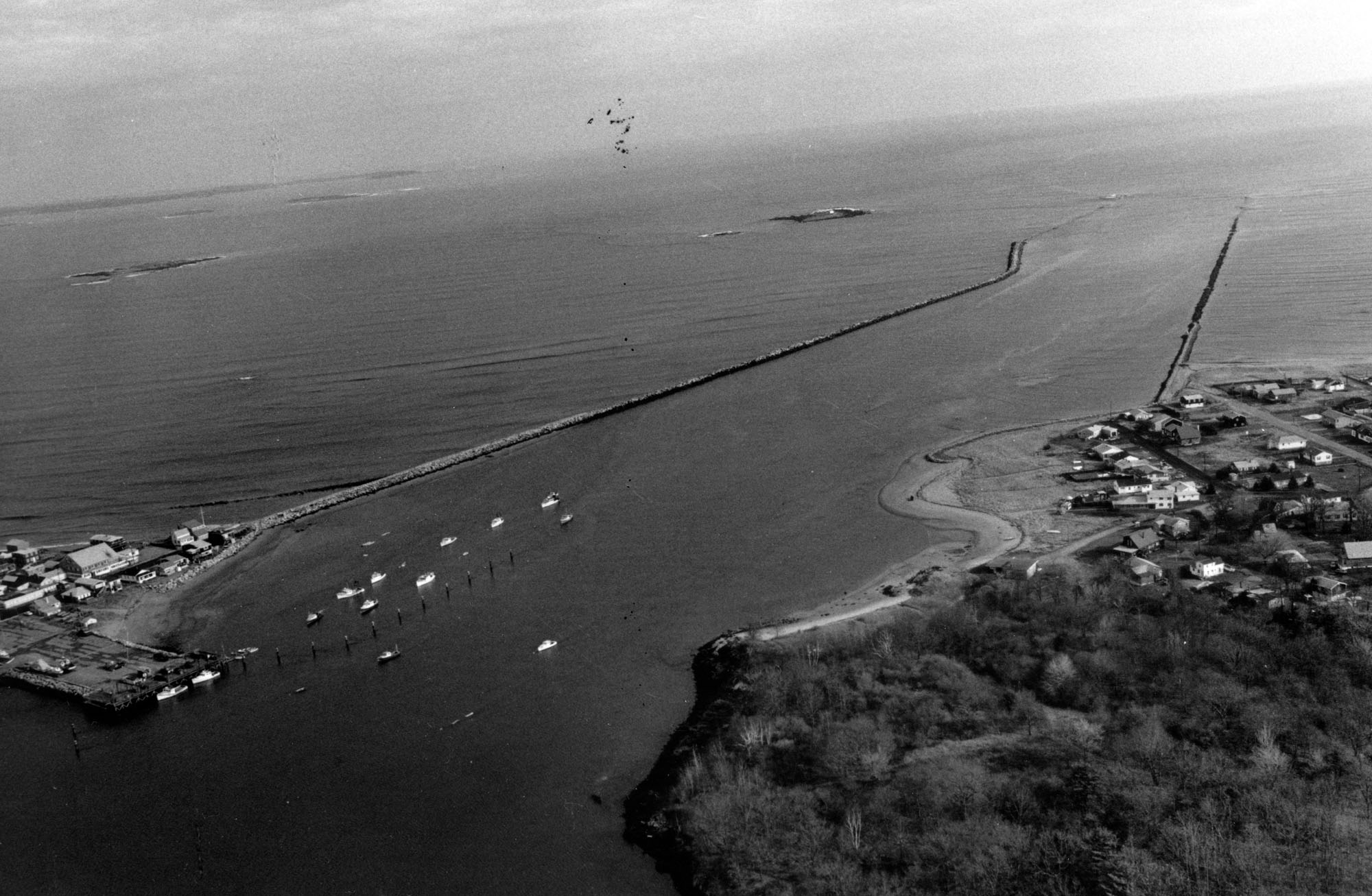
- A six-mile-long channel, eight feet deep (nine feet deep over ledge) with widths varying from 100-200 feet, extending from the sea to Half-Tide Island, between Biddeford and Saco.
- Three small stone jetties along the river, located at Chase Point (across from Moors Brook), Junkins Point, and HalfTide Island.
- A 6,600-foot-long breakwater at the entrance to the river, extending seaward from Ferry Beach in Saco.
- A 4,800-foot-long stone jetty at the entrance to the river, extending seaward from Hills Beach in Biddeford and parallel to the breakwater.
- The excavation of a small amount of rock.
In 1969, the Corps constructed a second series of navigation improvements on the Saco River. These improvements were constructed under Section 107 of the Continuing Authorities Program. They included:
- Two six-foot-deep anchorages at Camp Ellis Harbor, on either side of the six-mile channel, totalling 10.5 acres in area.
- A six-foot-deep turning basin, 10 acres in area, at Half Tide Island.
The third set of improvements was completed at Camp Ellis Harbor in 1983, also under Section 107 of the Continuing Authorities Program. They included:
- The construction of a six-foot-deep anchorage, three acres in area, located immediately east of the city pier.
- The construction of 13 icebreakers to deflect the flow of ice originating upstream. Ice flows moving down the Saco River had caused considerable damage to the state pier and fishing vessels moored in the harbor. The extent of damage to vessels ranged from splintering to cutting and sinking, forcing most fisherman to haul their boats ashore for the winter or relocate to another harbor during the winter months at considerable expense. Built by the Corps on an experimental basis, the icebreakers have successfully prevented further damage to the pier and fishing craft by deflecting ice away from the harbor. Consisting of two-foot-diameter steel columns filled with sand and capped with concrete, the icebreakers are driven into the river bed. They have reflectors for safety purposes. Eleven icebreakers were constructed to protect craft moored at the six-foot-deep anchorage east of the city pier, and two were built to safeguard the state pier and vessels unloading at the pier. One of the 11 icebreakers protecting the anchorage has a platform for osprey nesting.
Sand dredged from the entrance channel and the anchorages has been used to nourish the beaches adjacent to the river entrance.