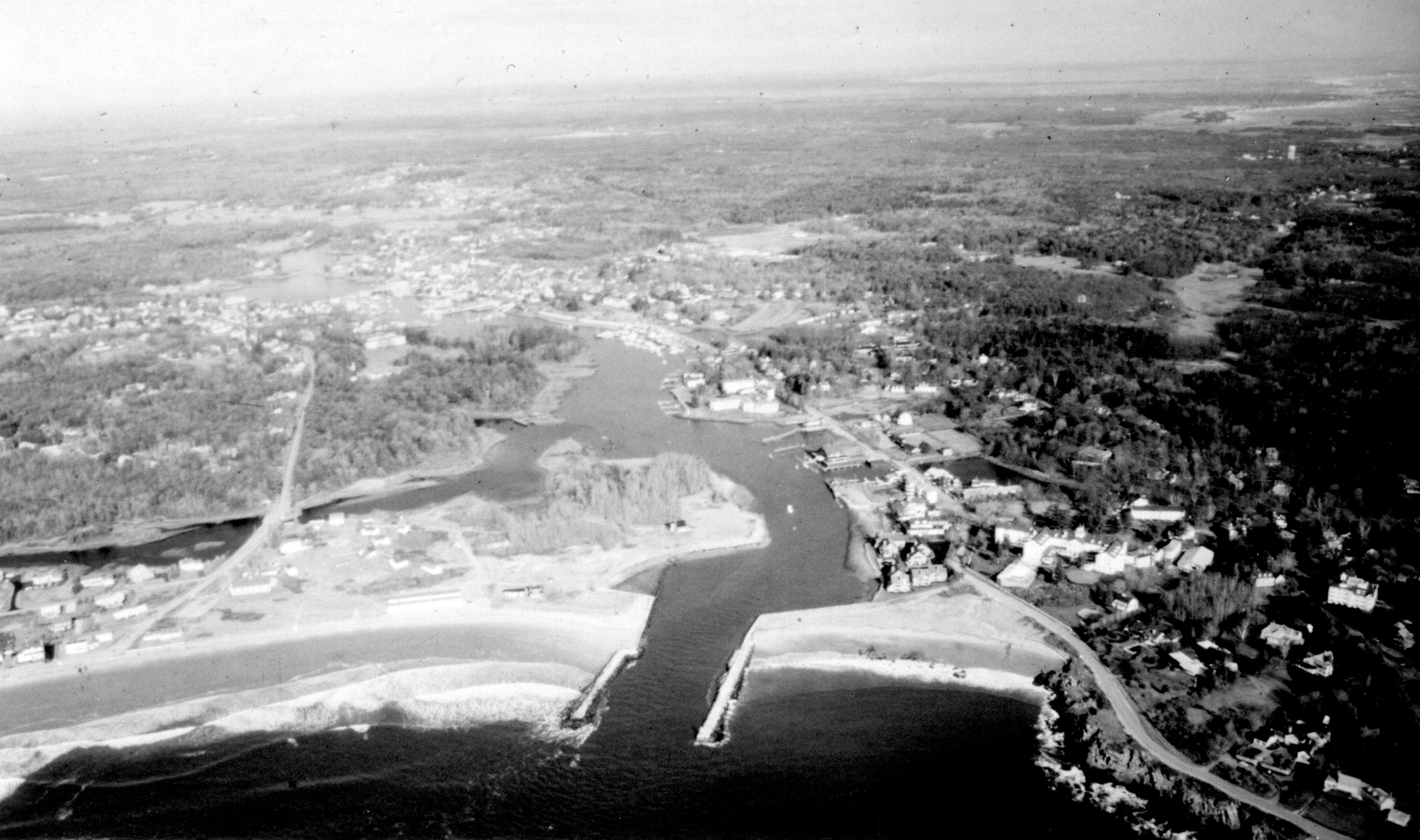
The Kennebunk River flows southeasterly along the border of Kennebunk and Kennebunkport, two popular summer resort communities on the coast of Maine, and empties into the Atlantic Ocean, about 30 miles southwest of Portland. The lower 1.1 mile of the river is used extensively by small lobstering and fishing fleets, yachts, and other recreational craft.
Original work by the Corps, completed in 1893, included construction of a 550 foot long stone breakwater on the east side of the entrance to the Kennebunk River; a 290 foot long stone jetty on the west side of the river entrance; a wharf (now the town landing), located about 700 feet upstream from the breakwater; a jetty on the east bank of the river, about 400 feet north of the wharf; and a four foot deep channel in the lower 1.1 miles of the river to Kennebunkport.
The most recent work in the Kennebunk River, completed in 1966, included construction of:
- A 1.1 mile-long channel with varying dimensions, extending from deep water to the vicinity of the Dock Square (Route 9) Bridge at Kennebunkport. For the first 1,700 feet, from deep water to the town landing, the channel is eight feet deep and 100 feet wide. From the town landing north for 2,300 feet, it is six feet deep and 100 feet wide. For its last 2,000 feet, to the vicinity of the Route 9 bridge at Kennebunkport, the channel is six feet deep and 75 feet wide.
- A six foot deep anchorage, four acres in area, located on the west side of the channel across from the Nonantum Hotel.
- A six foot deep anchorage, two acres in area, located on the east side of the channel, immediately upstream of the four acre anchorage.
- A 300 foot long extension of the west jetty.
- A 500 foot long sand fence extending from the base of the west jetty to Gooch Beach.