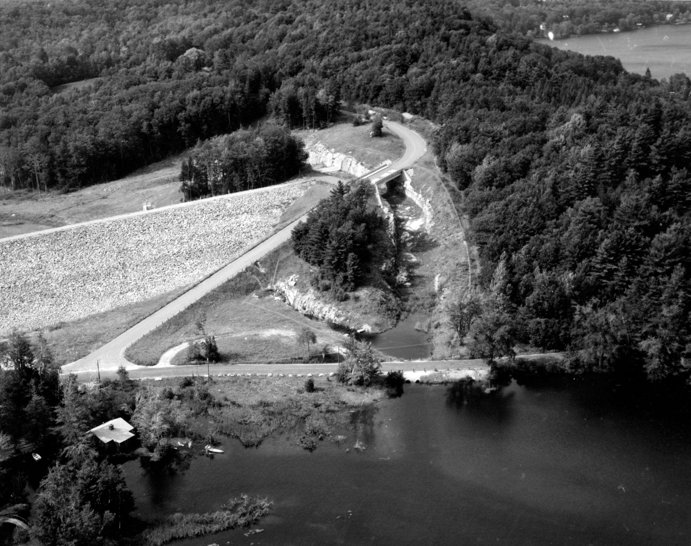
 Sucker Brook Dam is located in Winchester, about two miles southwest of Winsted. From Winsted, visitors travel south on Route 263 to signs for Highland State Park. The project consists of an earthfill dam with stone slope protection 1,160 feet long and 68 feet high; an ungated rectangular concrete conduit 426 feet long measuring three feet wide and three feet high; and a concrete chute spillway with a 60-foot long concrete weir. The weir’s crest elevation is 14 feet lower than the top of the dam.
The project provides flood protection for Winchester and Winsted. It acts in conjunction with the dam at Mad River Lake to reduce downstream flooding along the Mad and Still rivers, and with the dam at Colebrook River Lake to reduce flooding along the Farmington River.
Construction, which began in September 1966 and was completed in June 1971, required the relocation of about 1,300 feet of Sucker Brook Road. Dam costs totaled $2.3 million. The state of Connecticut is responsible for the operation and maintenance of the project. The project has prevented $1.6 million in flood damages since it was built (as of September 2011).
There is no lake at Sucker Brook Dam. The flood storage area of the project, which is normally empty and is only utilized to store floodwaters, covers 53 acres. Sucker Brook Dam can store up to 482 million gallons of water for flood control purposes. This is equivalent to 8.1 inches of water covering its drainage area of 3.4 square miles.
Hunters will find small game, such as rabbits and partridge, and stocked pheasant.
- Updated: 10 June 2015