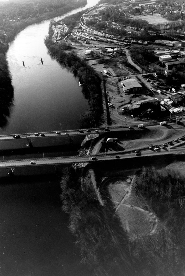
The Nashua Local Protection Project is located at the confluence of the Nashua and Merrimack rivers in Nashua, about 18 miles south of Manchester. The project protects about 70 acres of industrial and residential property in the lower section of the city.
Nashua experienced serious flooding in both March 1936 and September 1938. In 1936, the lower section of the city was flooded to depths ranging from ten to 17 feet, causing damage estimated at $1.9 million. In 1938, this area was flooded to depths ranging from five to eight feet. Construction of the project began in June 1946 and was completed in May 1949 at a cost of $273,000. The project is operated and maintained by Nashua.
The project consists of an earthfill dike approximately 3,025 feet long with a maximum height of 16 feet. The dike starts at the Boston and Maine Railroad Bridge that spans the Nashua River and extends easterly along the river’s right bank to the Merrimack River. The dike then continues southerly along the Merrimack River before ending at high ground south of Crown Street. The dike is continuous except for three sections of concrete floodwall. Stone slope protection was placed on the dike in areas where the river velocities are high. Three sections of concrete floodwall, totaling approximately 400 feet were built. One section of wall is on the right bank of the Nashua River, near its confluence with the Merrimack River. The other two sections are on either side of the Hudson Bridge, along the right bank of the Merrimack River. A pumping station, located adjacent to the Hudson Bridge behind the dike, handles interior storm and sanitary drainage from an area of 615 acres within the city. This drainage is carried through a conduit and is discharged into the Merrimack River. A second earthfill dike, approximately 400 feet long with a maximum height of five feet is located approximately 600 feet south of the 3,025-foot-long dike’s southern end, and is several hundred feet inland from the Merrimack River. It lies perpendicular to the river, across Cinder Road.